
Walk a Fayetteville Street Directory
Who lives or owns along a Fayetteville street is answered in stages. Start with the exact address, then preserve each identifier before moving on. The parcel card is the best first anchor because it separates the physical location from the owner's mailing address. GIS supplies the shape and adjoining lots. Deeds trace recorded interests. A lawful voter-list request or an address-arranged directory can add dated residence evidence.
No single step proves a full household. Keep owner, occupant, voter, deed party, and directory listing as separate roles until the same address and time period connect them.
- Search the address in Washington County DataScout and copy the situs, owner, mailing address, parcel, and legal description.
- Open the Fayetteville or county map, select the parcel, and inspect both sides of the street.
- Use the deed reference or owner name in the Circuit Clerk index to establish the recorded title chain.
- Request a lawful street or precinct voter extract when that dated roll fits the research question.
- Check Civic Access for recent work and reverse directories for an earlier listed household.
Search Fayetteville Streets by Situs
Washington County DataScout searches the current property roll. Situs means the physical parcel address. The owner mailing address is where assessment notices go, and it may point elsewhere. That difference can suggest that the owner does not receive mail at the parcel, but it does not identify who lives on the site.
The live portal resisted automated inspection during research, so exact current menus should not be overstated. The official workflow supports owner name, property address, parcel number, subdivision, and section, township, and range controls. Try initials and spelling variants for a person or business. Street browsing may work best through the map because wildcard behavior is not promised.
| Field | Input type | Use in a by-address search |
|---|---|---|
| Owner Name | Text | Find parcels held under a surname or entity |
| Property Address | Street text | Reach the physical situs record |
| Parcel Number | Identifier | Carry the land unit into maps and files |
| Subdivision | Text or selection | Compare lots in one recorded plat |
| Section/Township/Range | Land-grid controls | Find rural-edge tracts |
Map the Fayetteville Street Grid
The Fayetteville GIS map catalog links General Reference, address and ZIP, ward, permit, zoning, flood, utility, neighborhood, and city-limit layers. Search an address, select the parcel, then zoom until lot lines and street labels are clear. Click each adjacent polygon. Corner and rear lots deserve care because they may not share the target street name.
General Reference tools include address autocomplete, layer checkboxes, basemaps, map selection, measure, print, legend, and data download. A parcel map is planning and reference data, not a survey or title certificate. Copy the parcel identifier and legal description when the county layer supplies them, then confirm title through the deed record.
The official Fayetteville interactive maps menu shows the choices used in this street directory method.
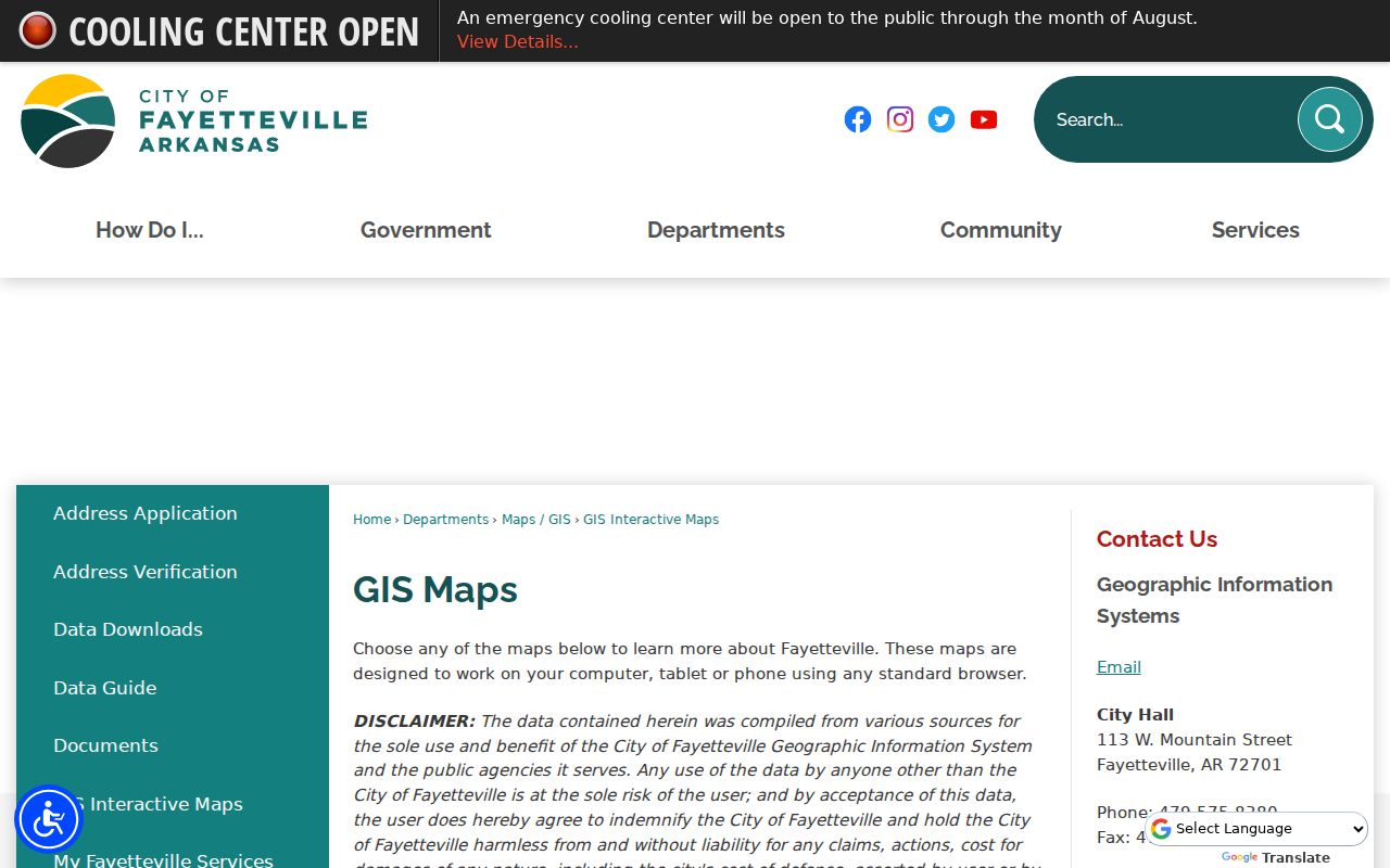
The menu makes clear that street, address, parcel, zoning, ward, and neighborhood questions belong to distinct map layers.
Note: City GIS layers come from varied sources, so confirm a parcel or boundary in the responsible land record before relying on it.
Fayetteville Street Records Compared
A Fayetteville street directory is built from address-keyed sources with different blind spots. The parcel number and legal description form the strongest bridge. Street spelling alone can fail after a renamed road, a directional-prefix change, or an annexation.
| Address source | Custodian | Street evidence | Access path |
|---|---|---|---|
| Property roll | Washington County Assessor | Owner, situs, mailing, parcel, improvements | DataScout or Assessor office |
| GIS | County and Fayetteville GIS | Lot geometry, adjoining parcels, layers | Free map or data download |
| Deeds and liens | Circuit Clerk and Archives | Parties, dates, legal description, title trail | Current index, archive index, counter, mail |
| Voter list | County Clerk and Election Commission | Dated voter address and precinct | Lawful extract request |
| City records | Development Services | Permit, inspection, license, and case chronology | Civic Access, staff, or FOIA |
| Reverse directory | Local library and museum | Listed householder or subscriber by number | Shelf, reader, or research request |
The chain is simple: address to parcel, parcel to owner, owner or deed reference to instrument, then date-specific resident clues. A result that skips one of those bridges deserves a second check.
Fayetteville Parcel Notice Layers
Fayetteville's Public Notification map adds a useful block tool. Its layers distinguish Property Owner, Property Occupant, Residential Occupant, and All Addresses Including Non-Deliverable. The city's March 9, 2026 instructions route users through GIS/Maps and General Reference, then the open-letter icon for the mailing-list dialog. The service can return up to 2,000 records.
Those categories need strict labels. “Occupant” is an address-label class used for public notice. It is not a named roster of everyone at that address. Use it to build notice destinations or inspect the address pattern, then return to official owner and voter records for named evidence.
The Public Notification service exposes the documented layer structure.
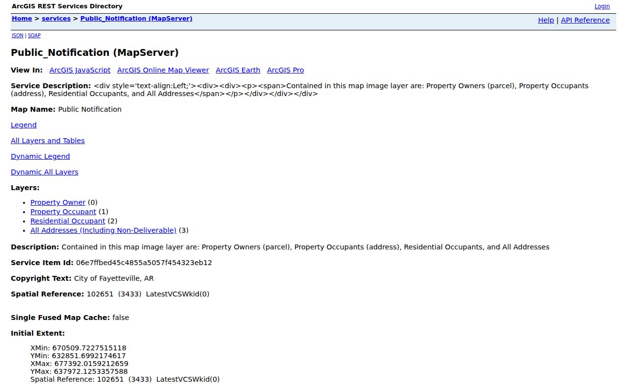
The screenshot helps separate parcel owners from address-only occupant labels before any street list is interpreted.
Fayetteville Deeds Along a Street
The Washington County Circuit Clerk records deeds, mortgages, releases, liens, plats, surveys, powers of attorney, and other instruments affecting land. Start with the parcel card's current deed reference when present. Otherwise, search the owner as grantee. A grantee receives an interest; a grantor conveys or encumbers one. Verify the same legal description before treating an earlier deed as the same property.
Current indexed land and lien records cover 1992 forward. At 1991, move to the Washington County Archives land database, which reaches back to 1834. Search controls include grantor or grantee name, record type, dates or year, book, page, and legal-description terms. Original handwritten indexes and books remain the fallback when the convenience database has an error or missing image.
The county records gateway routes both eras. Current records also have a weekday Circuit Clerk counter, phone help, and mail channels. Archives offers its counter on Wednesday, with a midday closure.
- Parcel
- A county-mapped unit of land.
- Situs address
- The physical address assigned to the parcel.
- Plat
- A recorded drawing that identifies subdivision lots, blocks, streets, and dimensions.
- Criss-cross directory
- A directory arranged by street and house number.
Fayetteville Permits by Address
Fayetteville Civic Access supplies a building timeline that the property roll cannot. City guidance says permits, plans, business licenses, code-compliance cases, certificates of occupancy, and inspections created since roughly 2020 are likely searchable. Start with number and street name, wait for autocomplete, omit punctuation, and choose the suggested address. Exact Phrase helps keep results to one site.
Select a record type before using advanced date filters. Results can be narrowed on the left, and a blue record number opens details. Attachments may include permits, plans, or occupancy certificates, though some records lack attachments and some protected or copyrighted content stays closed.
Development Services provides phone and email help. Older or missing city records go through the Fayetteville FOIA portal, which supports new requests and tracking. Arkansas FOIA requests should identify records, dates, and format. Inspection and a requester's own image capture are ordinarily free.
Voters in Fayetteville Street Records
VoterView verifies one registration from first name, last name, date of birth, and county. It does not enumerate a Fayetteville street. A by-street project instead requires a lawful county voter-list extract from the Washington County Clerk or Election Commission. Specify the street or precinct, requested fields, medium, and date.
Arkansas computerized county lists include at least names, addresses, and precinct numbers. Secure-voter addresses must be excluded. The statute caps electronic list fees at $10 for up to 5,000 names, $25 for 5,001 through 25,000, and $50 above 25,000. Printed lists may cost no more than two cents per name and address.
A voter record is dated evidence, not proof of the whole household. Arkansas has no party registration. An inactive status may follow address-confirmation rules and does not by itself prove a move or cancellation.
Reverse Fayetteville Street Directories
A reverse or criss-cross volume is arranged by street and house number. It can identify a listed householder or telephone subscriber when a modern parcel roll shows only the owner. Fayetteville Public Library and Shiloh Museum hold selected directories and telephone books. Polk cross-reference material includes a 1996 volume, while regional Fayetteville, Springdale, and Rogers directories continue through later years.
Keep this use narrow. A printed directory reflects a canvass or listed line, not a census. Missing names may result from a missed canvass, an unlisted number, a move, or a publication gap. Photograph the title page and abbreviation key, then copy the entry exactly. Compare the prior and next volume before inferring change.
The full publisher runs and reading method belong to the Fayetteville city directory. For street work, the key task is bridging the historical address to today's parcel.
Bridge Fayetteville Address Changes
A house number is not permanent land identity. Fayetteville growth, annexation, street-name changes, directional prefixes, and number changes can make one lot appear under several addresses. Do not force a modern street label into an old index. Use the legal description, parcel geometry, recorded plat, Sanborn sheet index, and nearby fixed landmarks.
Sanborn maps exist for Fayetteville editions dated 1886, 1892, 1897, 1904, 1908, 1913, 1919, and 1930, plus a corrected 1930 to 1948 set. They show building footprints, use, materials, street names, and fire context. Downtown and central neighborhoods have the strongest early map and directory trail. Newer west and northwest corridors are better documented by recent plats, parcels, and permits.
The city E-911 Address Coordinator assigns addresses and unit numbers and can issue an address-verification letter. USPS confirms delivery and ZIP, while My Fayetteville Services confirms whether a postal Fayetteville address is actually inside city limits.
Note: A legal description follows the land more reliably than a street name or house number.
Why Fayetteville Deeds Go Deep
Washington County officials moved records to Fincher's Cave before the courthouse burned in 1862. That act preserved early nineteenth-century land, court, and probate sequences that many Arkansas counties lost. The modern Fayetteville street directory therefore has an unusually long paper trail behind it: land records begin in 1834, and original-entry and plat material begins even earlier.
Depth does not mean full web access. The 1834 through 1991 archive index points to books and images, but original volumes, handwritten indexes, surveys, or plats may require Archives staff. The current Circuit Clerk system covers the later period. A careful street history crosses that 1991 line instead of stopping when the newer index ends.
Limits of Fayetteville Street Directory
Public property data omit many people who live at an address. A deed records an interest in land, not day-to-day presence. A permit applicant may be an agent or contractor. Voter records exclude people who are not registered and suppress secure-voter addresses. Utility customer names, delivery data, motor-vehicle addresses, sealed court details, restricted vital records, and adoption files are not a public street roster.
Use the narrowest source that answers a lawful personal question. Stop when the trail reaches confidential data. Correct an error with the office that created the record. Never treat a commercial compilation as a certified street directory, and never infer current presence from an old index without a second dated source.
Lawful use. Fayetteville address records support civic, family, property, and historical research. Do not use them to stalk, harass, threaten, trespass, or defeat protected-address rules.